The Village Inn of Woodstock
- The Village Inn of Woodstock
The Village Inn of Woodstock (Woodstock,США)
     |
| Категория отеля: | 3-звездочный отель |
| Адрес: | 41 Pleasant Street, Woodstock, VT 05091, США |
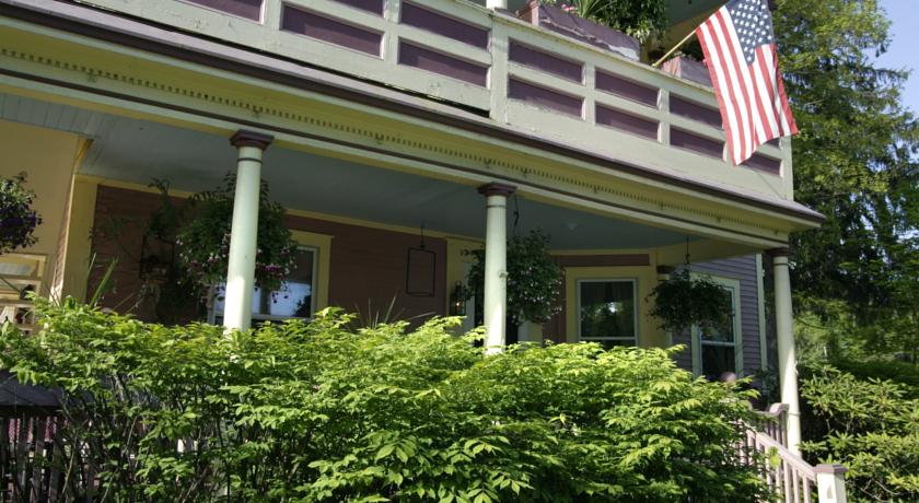
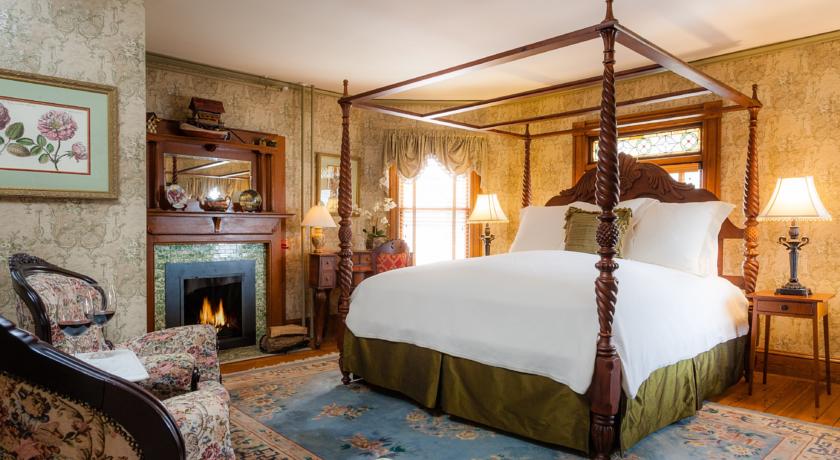
| Описание: | Less than 1 mile from Billings Farm and Museum in Woodstock, this charming B&B offers a gourmet breakfast. A tavern is located on site. Massage services are available. All guest rooms include free Wi-Fi.Each elegant room at The Village Inn of Woodstock is furnished with period pieces. An adult-only bed and breakfast, guests can enjoy a quiet getaway. Cable TV is included. Select rooms feature a spa bath.Before exploring the nearby shops and covered bridges, guests can start their day with a hearty breakfast. A main entre along with eggs, bacon and fruit is served daily. Coffee, tea and juice is included.The Village Inn of Woodstock is 7 miles from Simon Pearce glass blowing and restaurant. Serving authentic Italian fare, Pane E Salute is 5 minutes walk away. |
| Еда и питье: | Бар |
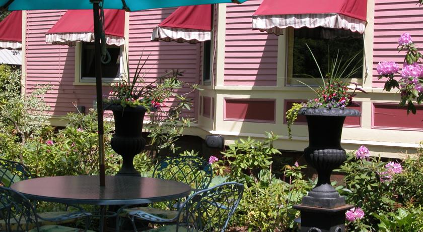
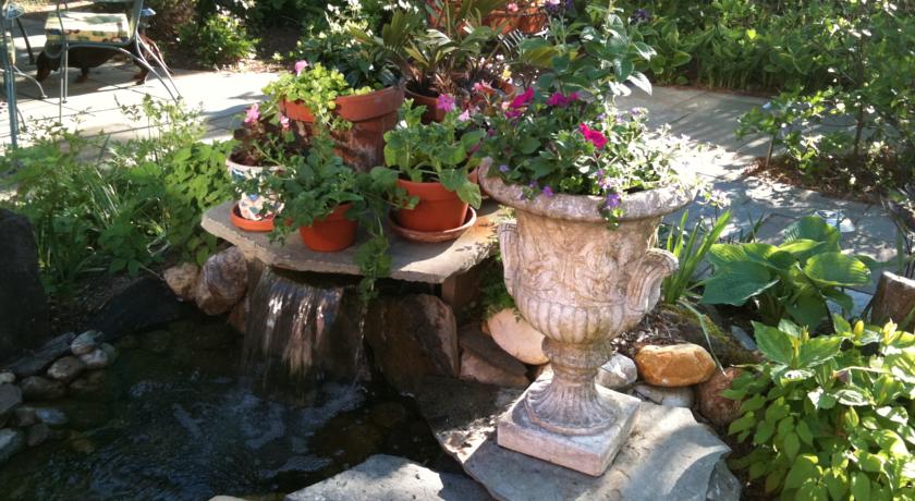
| На свежем воздухе: | Сад, Терраса |
| Парковка: | Бесплатно! Бесплатная Общественная парковка на месте (предварительный заказ не требуется) . |
| Услуги: | Номера для некурящих, Отопление, Курение на всей территории объекта размещения запрещено, Кондиционер |
| Спорт и отдых: | Массаж |
| Сервис: | Услуги консьержа, Дневная уборка номера, Люкс для новобрачных |
| Интернет: | Бесплатно! Wi-Fi предоставляется на территории всего отеля бесплатно. |
| Языки общения: | на английском, на немецком |
| Время заезда/выезда: | 15:00 - 20:00 / До 11:00 |
| Домашние животные: | Размещение домашних животных не допускается. |
| Банковские карты: | |
| Номерной фонд: | Отель типа "постель и завтрак": 8 номеров |
| Координаты: | ш. 43.62662845998562 д. -72.5111442804336 на карте |
| | |
Каталог отелей.
Полезное
Смотреть что такое "The Village Inn of Woodstock" в других словарях:
Woodstock, Vermont — Infobox Settlement official name = Woodstock, Vermont settlement type = Town nickname = motto = imagesize = image caption = image map caption = mapsize1 = map caption1 = subdivision type = Country subdivision name = United States subdivision… … Wikipedia
Counterculture of the 1960s — The Peace Sign, designed and first used in Britain in the Campaign for Nuclear Disarmament, became a major symbol of the counterculture era The counterculture of the 1960s refers to a cultural movement that mainly developed in the United States… … Wikipedia
List of coalition military operations of the Iraq War — Operation Aloha redirects here. For the band, see Operation Aloha (band). Nordlicht redirects here. For the Kriegsmarine ship, see SS Nordlicht. Operation Falcon Freedom redirects here. For the United Nations Security Council Resolution 1973… … Wikipedia
Twin Gables of Woodstock — (Woodstock,США) Категория отеля: 2 звездочный отель Адрес: 73 Tinker Street, Woodstoc … Каталог отелей
Napton-on-the-Hill — For the drug with trade name Napton, see Chlordiazepoxide. Coordinates: 52°14′42″N 1°19′34″W / 52.245°N 1.326°W / 52.245; … Wikipedia
Huntley, Illinois — Chicagoland municipality muni name = Huntley muni = Village date = 1851 state = Illinois county = McHenry county2 = Kane tcounty = Kane township = Grafton township2 = Rutland gov = Council manager head label = Village President gov head = Chuck… … Wikipedia
White Hart — The White Hart ( hart is an old word for stag) was the personal badge of Richard II, who derived it from the arms of his mother, Joan The Fair Maid of Kent , heiress of Edmund of Woodstock. In the Wilton Diptych (National Gallery, London), which… … Wikipedia
Oxfordshire Blue Plaques Board — The plaque commemorating Thomas and Martha Combe in Jericho, Oxford. The Oxfordshire Blue Plaques Board, established in 1999, is administered by the Oxford Civic Society. It oversees the installation of blue plaques on historic buildings in the… … Wikipedia
National Register of Historic Places listings in Windsor County, Vermont — Location of Windsor County in Vermont This is a list of the National Register of Historic Places listings in Windsor County, Vermont. This is intended to be a complete list of the properties and districts on the National Register of Historic… … Wikipedia
Chadlington — Coordinates: 51°53′53″N 1°31′26″W / 51.898°N 1.524°W / 51.898; 1.524 … Wikipedia